Project
Community
News
My App
My maps
Maps of Plainfield, Illinois
Advanced search
All
Private
Favorites
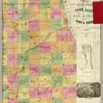
Cook, Dupage, Will, Kankakee, Kane & Kendall.
1862|Rees, J. H.
1:130 000
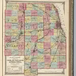
Atlas of Illinois, Counties of Cook, Du Page, Kane, Kendall and Will.
1872|Lloyd, H.H.
1:253 440
La Salle, Grundy, Livingston counties.
1870|Campbell, R.A.
1:350 000
McHenry, Lake, Kane, Du Page, Cook, Will, Kendall counties.
1870|Campbell, R.A.
1:350 000
Lockport Township, Town. 36 N. Range 10 East., Will County, Illinois.
1873|Thompson Bro's & Burr
1:31 680
Atlas of Illinois, Counties of Lasalle, Grundy and Livingston.
1872|Lloyd, H.H.
1:253 440
Map of Indiana County Seats
1866|Larrance, Isaac, 1804-1896
1:5 068 800
1600
1650
1700
1750
1800
1850
1900
1950
2000
History
Old maps of Plainfield, Illinois
Discover the past of Plainfield, Illinois on historical maps
Old maps of Plainfield, Illinois
Discover the past of Plainfield, Illinois on historical maps
Explore Maps
Discover History
Parent places
Illinois
Related places
© MapTiler
© OpenStreetMap
 1862|Rees, J. H.1:130 000
 1872|Lloyd, H.H.1:253 440
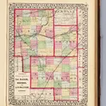 1870|Campbell, R.A.1:350 000
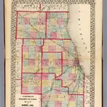 1870|Campbell, R.A.1:350 000
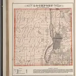 1873|Thompson Bro's & Burr1:31 680
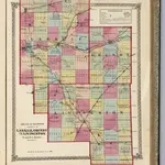 1872|Lloyd, H.H.1:253 440
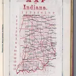 1866|Larrance, Isaac, 1804-18961:5 068 800