地图 奈茨敦 (印地安納州)
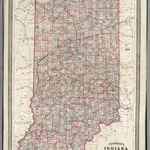 1870|Johnson, A.J.1:862 000
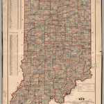 1874|Higgins, Belden & Co.
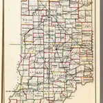 1866|U.S. General Land Office1:1 140 480
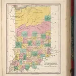 1827|Finley, Anthony1:1 675 000
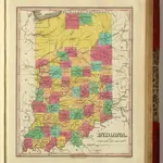 1831|Finley, Anthony1:1 675 000
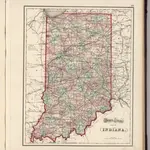 1874|Gray, Ormando Willis1:1 233 000
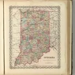 1857|Colton, G.W.1:1 280 000
奈茨敦 (印地安納州)的老地图
在历史地图上发现 奈茨敦 (印地安納州) 的过去
奈茨敦 (印地安納州)的老地图
在历史地图上发现 奈茨敦 (印地安納州) 的过去
寻找 谷歌地图应用程序接口替代方案?